

It's not a bird, and it's not a plane — it's a drone, and you may seem them flying over farmers' fields in the summer.
Drones are just one way of capturing land information in terms of elevation and crop health. And the operator can use this information to help with designing tile drainage systems.
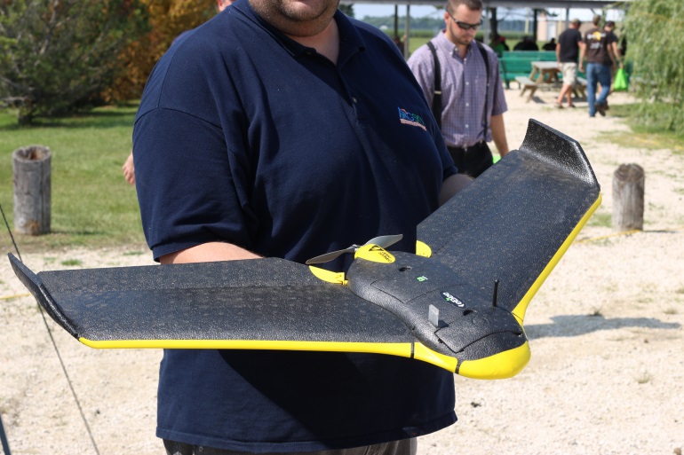
"By flying over a quarter section, we can obtain a quite number of pictures," says Warren Genik, president of AgSky Technologies. "From those numerous pictures, we can extract elevation data and provide a preliminary report to determine if tile drainage is going to be effective, or what alternatives and options are out there for them."
Genik had one such drone on display at the Quarry Seeds Valley Soybean Expo in Oakville last week. He says the small, black flying object can prefers good weather, not working in rain or snow, however it can operate in up to 45 to 50 km/hr winds, but it is sometimes more cooperative than other methods of land assessment.
"We don't have to have access to the fields, so we can do it on wet years when the field is too wet to drive on for regular surveying," he says.
And when it comes to using the drone's data, it can be more precise than ground surveying. Rob Holter-Ferguson, co-owner of Frontier Drainage Systems, says the drones make their work of planning tile drainage more efficient.
"Ground surveying gives us a really good idea of the exactly elevations we're dealing with. The drone, we've shown, we've used lots of audit points and we've seen that we have the accuracy with the drone," he says. "It also gives us a lot more information. We get an actual image of the field as it stands, so it gives us a new tool to kind of explore new ways of looking at drainage. We can look at the crop health."
He says that there are still points they need to map by hand, but overall the drone helps them make better. informed decisions.
Genik says the drones are still fairly new in North America, although they've been used quite a bit in Europe and Australia.


 Fri, Apr 19, 7:00 PM
 Transport, Skilled Trades, Professionals
 Featured